|
Click here to return to the main site. Book Review
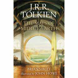
HarperCollins publishes the hardback J. R. R. Tolkien: The Maps of Middle-Earth. This book collects together for the first time Tolkien’s maps of Middle-Earth, Wilderland, and Beleriand – re-illustrated by John Howe and presented here as detailed full colour fold posters. It is completed by an additional map of the island kingdom of Numenor, taken from Amazon Prime’s The Rings of Power TV Series. The main body of the book incorporates detailed text by Brian Sibley. John Howe is a well-known Tolkien artist who cut his teeth on The Lord of the Rings trilogy, before contributing to The Rings of Power TV Series and the imminent The Lord of the Rings: The War of Rohirrim animated release. Brian Sibley is considered an expert in the field, having adapted the 1981 radio dramatisation of The Lord of the Rings, and written the Sunday Times bestselling The Fall of Numenor. Here, he provides a full glossary of events, places, and names. This release is likely to split opinions down the middle. It is a well-presented hardback book, and I particularly like the pencil sketches which are very impressive. Primarily, however, this is all about the full-colour maps which sit, detached, at the inside front and rear covers. Some people will undoubtedly complain that the maps are not physically part of the book, or that they can’t be mounted in a picture frame because of the folds. There are always dissenters to every release though. The bottom line is you need to be an avid J. R. R. Tolkien fan to purchase this book and get the most out of it. My opinion is, if you are, you won’t be disappointed. I have read The Lord of the Rings books and enjoyed the movies but would not consider myself a keen Tolkien enthusiast. Nevertheless, I found the book – and particularly the attractive maps – of interest, although casual readers may consider the book recommended retail price to be a little high. 8
Buy this item online
|
|---|


